- November 18, 2025
Summarize with AI
Not enough time? Get the key points instantly.
Get summary:
Why Roadside Assistance App is Needed?
A driver's car breaks down on a highway at 11 PM. They open an app, tap "I need help," and expect a tow truck at their exact location within 30 minutes. That's the promise your platform makes the moment someone downloads it.
Delivering on that promise is harder than it looks. Real-time GPS accuracy, intelligent provider matching, live ETA updates, and fallback logic when the nearest provider is unavailable — these are all engineering problems your system must solve before a single user opens the app under stress. Get any layer wrong and your first bad experience becomes a one-star review that defines the product's reputation.
By the end of this guide, you'll know exactly how to develop a roadside assistance app — the core feature set, the architecture decisions that determine reliability, the tech stack for real-time dispatch, and where most first builds go wrong.
Why Roadside Assistance Apps Are Harder to Build Than They Appear
On the surface, a roadside assistance app looks like a two-sided marketplace: a user requests help, a nearby provider accepts and travels to the location. That core loop is straightforward. The complexity lives in every edge case around it.
Location accuracy is safety-critical : When someone is stranded on a highway in the dark, "approximately correct" GPS is not acceptable. Your app needs to handle GPS drift, poor signal in tunnels and parking structures, and the difference between the user's device location and the actual safe pickup point. A provider dispatched to the wrong side of a highway interchange is not just an inconvenience — it can be dangerous.
Real-time dispatch has strict latency requirements : Every second between a user's request and a confirmed provider acceptance is felt. Backend systems that can't process location updates, match providers, and push confirmations within 2–3 seconds create visible lag that feels broken. This rules out traditional REST polling architectures for the core dispatch loop — you need WebSockets or server-sent events.
Provider availability is dynamic and unpredictable : A provider who was available 60 seconds ago may now be mid-job. Your matching algorithm needs live availability signals, not cached state. Providers who go offline, reject too many requests, or have their app in the background all create dispatch failures your fallback logic must handle gracefully.
Offline and low-signal scenarios are the norm, not the edge case : Users break down in exactly the places with the worst connectivity — underground car parks, rural roads, highway underpasses. Your app must handle partial connectivity, queue requests during signal loss, and resume state cleanly when connection restores.
If you're planning a roadside assistance product and want to pressure-test your architecture before committing to a build, CoreFragment's mobile app development team has built an automobile assistance platform with real-time vehicle diagnostics and provider dispatch — and can review your approach before development starts.
Core Features Your Roadside Assistance App Must Have
Not every feature is equal. Some are table stakes — without them, the app doesn't function. Others are differentiators that improve conversion and retention. Here's how they split:
Table Stakes — Without These, You Don't Have a Product
Real-time GPS location sharing between the stranded user and the assigned provider. Both parties need to see each other's live position on a map. The user needs to confirm the provider is actually coming. The provider needs accurate navigation to the exact breakdown point.
Service type selection : Towing, tyre change, fuel delivery, battery jump-start, lockout assistance, and winching are standard categories. Each has different pricing, required equipment, and provider qualification. Your dispatch system must match requests to providers who have the right equipment, not just who is nearest.
Provider matching and dispatch : The matching algorithm needs to consider distance, availability status, current job load, service type capability, and average response time. A provider 500 metres away who is finishing a job is often a worse match than one 2 kilometres away who is fully free.
Live ETA and job status tracking : The user must see: provider accepted → provider en route → provider arrived → service in progress → completed. Each state transition must push a notification and update the map. A user who can't see their provider's status will call your support line.
In-app communication : Users and providers need to message or call each other without exchanging personal phone numbers. All communication should be masked — routed through your platform — so neither party's personal number is exposed.
Payment processing : In-app payment with card, wallet, or insurance billing depending on your market. Subscription users (roadside club members) need a different billing path than pay-per-use customers.
Differentiating Features — These Separate Good Products from Average Ones
OBD-II vehicle diagnostics integration : A Bluetooth OBD-II adapter (like the ELM327) plugged into the car's diagnostic port can transmit fault codes, battery voltage, tyre pressure, and engine status directly to your app before the user even selects a service type. The app can then pre-populate the service request with the likely issue — reducing friction and improving dispatch accuracy. CoreFragment built exactly this in the Smart OBD Device project and the Automobile Assistance App.
Predictive service suggestions : If the OBD data shows a low battery voltage reading (below 12.2V at rest), the app can proactively suggest a battery check before the user breaks down. Preventative prompts that deliver value before an emergency dramatically improve retention.
Fleet and B2B management portal : Corporate fleets need a different interface — bulk vehicle registration, centralized billing, usage reporting per vehicle, and SLA tracking per service request. Building a web-based fleet portal alongside the consumer app doubles your addressable market.
Multi-language and multi-currency support : If you're targeting more than one country, localization is not optional. Payment methods, tax calculations, and legal service agreements all vary by jurisdiction.
Tech Stack Decisions That Determine Reliability
Real-Time Location Architecture
The core real-time loop — user location → server → provider map update; provider location → server → user map update — cannot run on standard HTTP polling. Polling at 5-second intervals introduces 5 seconds of lag on every location update. For a moving provider vehicle, that's visible on the map as jumpy, inaccurate position updates.
Use WebSockets for bidirectional real-time location streaming. A persistent WebSocket connection between the app and your backend enables sub-second location updates with minimal overhead. Your backend needs to broadcast location updates only to the relevant connected clients — not to everyone — which requires a pub/sub architecture. Redis Pub/Sub is the standard choice for this: each active job gets a channel, the provider publishes location updates to it, and the user's app subscribes and renders them on the map.
For the mapping layer, Google Maps Platform (Maps SDK for Android/iOS, Directions API, Distance Matrix API) is the default choice because of global coverage and route quality. Mapbox is a strong alternative — more customizable, better pricing at scale, and offline map tile support that helps in low-connectivity scenarios. For an Indian market focus, MapmyIndia offers better granularity on Indian roads and addresses.
Provider Matching Algorithm
Naive proximity matching — always dispatch the nearest available provider — fails in real deployments because it doesn't account for provider acceptance rate, job queue, or traffic conditions. A provider 800 metres away with a 40% acceptance rate and 2 pending jobs is a worse dispatch candidate than one 1.5 kilometres away with a 95% acceptance rate and an empty queue.
Your matching logic should score candidates on a weighted combination of:
Factor | Why It Matters | Weight |
|---|---|---|
Distance | Travel time directly affects ETA | High |
Availability Status | In-Job providers cause dispatch failures | Critical - disqualifying |
Service type match | Provider must have right equipment | Critical - disqualifying |
Acceptance rate (30 day) | Low-acceptance providers inflate response times | Medium |
Current active jobs | Providers mid-job may not arrive promptly | Medium |
Average job completion time | Reflects provider efficiency | Low |
User rating of provider | Quality signal for premium matching | Low |
Send the request to the top-scored available provider first. Set a 45–60 second acceptance window. If rejected or timed out, cascade to the next candidate. Log every dispatch attempt and outcome — this data drives algorithm tuning over time.
Mobile App Architecture
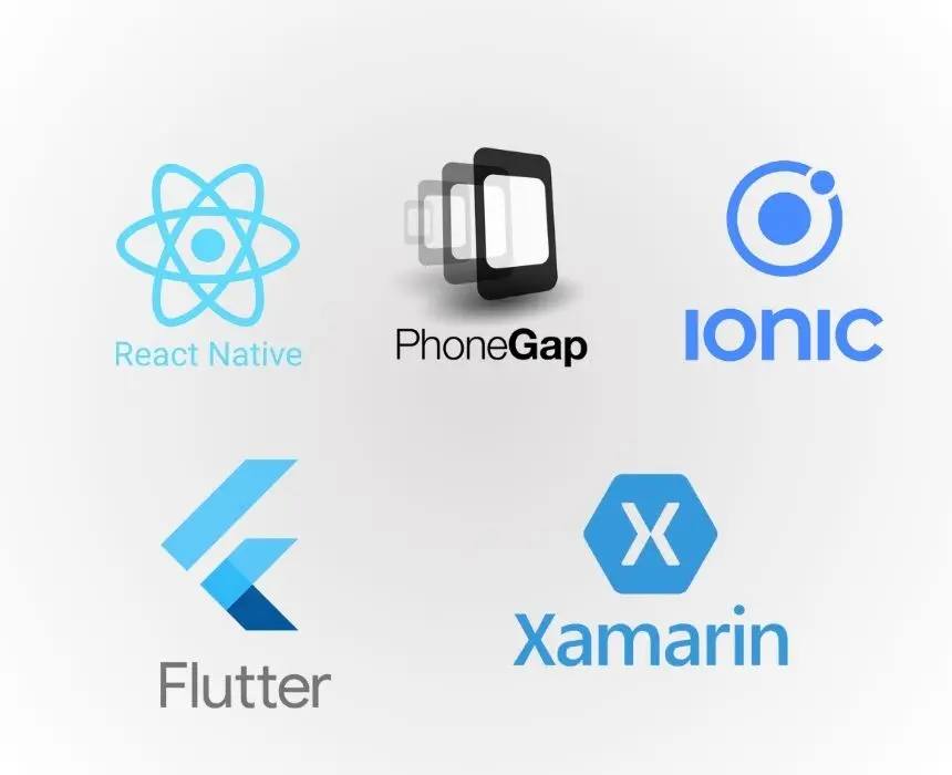
React Native is the right choice for most roadside assistance apps at first build. A single codebase for iOS and Android, with access to native Bluetooth APIs (needed for OBD-II integration via react-native-ble-manager), native GPS (react-native-geolocation-service), and native push notifications (Firebase Cloud Messaging). The productivity advantage of a shared codebase matters more than native performance at this stage.
Flutter is a strong alternative if your team has Dart experience. Flutter's rendering engine gives more consistent UI across Android versions — an advantage in markets like India where Android device fragmentation is significant.
For background location tracking — provider apps need to stream GPS even when the app is backgrounded — use react-native-background-geolocation (not the standard geolocation library, which stops updating in background). Background location requires explicit permission handling and different implementation patterns for iOS and Android.
Component | Technology Choice | Reason |
|---|---|---|
API Server | Node.js (Fastify) or Go | High-concurrency WebSocket handling |
Real-time pub/sub | Redis Pub/Sub | Sub-millisecond message delivery |
Primary database | PostgreSQL with PostGIS | Geospatial queries for provider lookup |
Job queue | Bull (Redis-backed) | Async dispatch, retry logic, timeout handling |
Push notifications | Firebase Cloud Messaging | Cross-platform, reliable delivery |
Maps & routing | Google Maps Platform or Mapbox | Geocoding, ETA, directions |
Payments | Depends on country allowance | PCI-compliant payment processing |
Cloud hosting | AWS (EC2 + RDS + ElastiCache) | Mature managed services, global regions |
PostGIS on PostgreSQL deserves specific mention. Geospatial provider lookup - "find all available providers within 10km of this coordinate who offer tyre change service" — is a query you'll run on every incoming request. PostGIS's ST_DWithin with a spatial index on provider location makes this query fast at scale. Running this as a naive latitude/longitude range query in a standard database will not perform at volume.
Roadside Assistance App Development: Decision Checklist
Before committing to architecture and sprint planning, verify each of these:
Two-sided vs. own-fleet model decided: Are you building a marketplace (independent providers join your platform) or dispatching your own employed fleet? The provider onboarding, pricing, and legal structure are completely different. Decide before building the provider app.
Real-time architecture chosen: Confirmed WebSockets or server-sent events for the dispatch loop - not polling. REST polling cannot deliver the sub-3-second update latency a roadside app requires.
Background location strategy confirmed per platform: iOS and Android handle background GPS differently. iOS requires significant-location-change monitoring or background modes declared in Info.plist. Android requires foreground services. Test both before assuming they behave the same.
OBD-II integration scoped: If including vehicle diagnostics, decide at architecture stage - Bluetooth Classic (ELM327) vs BLE-based OBD adapters have different iOS Bluetooth permission requirements and different library support in React Native.
Geospatial database set up with PostGIS: Standard relational database radius queries will not scale. PostGIS with spatial indexing on provider location is non-negotiable for production-grade dispatch.
Dispatch fallback logic designed: What happens when no provider accepts within the timeout window? Auto-expand radius? Notify user of delay? Escalate to manual dispatch? Design the failure path before it becomes a production incident.
Communication masking decided: Will you route in-app calls and messages through a masking layer (Twilio Proxy, Exotel) to protect user and provider privacy? This affects both the backend and the UX design of the communication screen.
Fleet/B2B portal scope defined: If corporate fleet customers are in your roadmap, their data model (vehicles, drivers, cost centres, SLAs) needs to be designed into the schema from the start - not retrofitted later.
Conclusion
Building a roadside assistance app that works under pressure requires getting three things right before writing a single line of business logic: real-time WebSocket architecture for dispatch, PostGIS-backed geospatial queries for provider matching, and platform-specific background location handling for the provider app. Without these foundations, everything else — the matching algorithm, the ETA display, the fallback logic — sits on an unstable base.
The teams that ship reliable roadside apps are the ones who design the failure paths as carefully as the happy paths. What happens when no provider accepts? When GPS drifts at the worst moment? When the provider app goes to background and stops streaming? Answering those questions in the design phase costs hours. Answering them after a production incident costs weeks.
If you're planning a roadside assistance or automotive services app and want a technical review of your architecture before development begins - CoreFragment's mobile and backend team has built automotive assistance products with OBD-II hardware integration, real-time vehicle diagnostics, and provider dispatch. We can review your feature scope and tech stack and tell you where the risk is before you commit to a sprint plan.